
Publications
These publication have been produced with the financial assistance of the Estonia – Russia Cross Border Cooperation Programme 2014-2020. The content of this publication is the sole responsibility of University of Tartu (UTartu) and can under no circumstances be regarded as reflecting the position of the Programme, Programme participating countries alongside with the European Union.

Report on the harmonizing methods of field sampling, sample analysis and spatial modelling
This current report summarizes the current knowledge and uncertainties related to the spatial patterns of nature assets in the programme area and provides smart solutions on how to convert traditional monitoring data into values of ecosystem function and service. Ultimately, this methodology is applied at the later stages of the project to predict the spatial patterns of nature assets in the Gulf of Finland under current and future environmental conditions. Report on the harmonizing methods of field sampling, sample analysis and spatial modelling

Environmental considerations and blue economy
The ADRIENNE project analyses how human activities affect biodiversity, functioning and ecosystem services in the Gulf of Finland (GoF) and seeks to find ways to mitigate damage to and to assure the sustainability of the marine environment. ADRIENNE has produced a publicly accessible geospatial portal PlanWise4Blue (PW4B) that can assess interactive responses of various human-induced stressors on the GoF ecosystem under different nutrient concentrations and climate change scenarios. The following human activities are included in the PW4B tool: dredging, wind park development, shipping, commercial fishing, harbour development and maintenance, extraction of minerals (mining), military activities, wastewater discharge, coastal protection, fish farming, mussel and algal cultivation, marine plant harvesting, tourism and leisure activities. All these human activities exert different pressures on the biota and habitats and one human activity often causes multiple pressures. Consequences of these pressures can cause severe environmental impacts and challenges. Environmental considerations and blue economy

Sustainable management solutions for marine environment
The Baltic Sea is one of the most intensively used seas of the world and therefore impacted by many burdens affecting the sustainability of the marine environment. The rapidly growing demand of shipping, fisheries, aquaculture, the energy sector and increasing nutrient loads from agriculture are some of the burdens affecting the sustainability of the marine environment. Allowing sustainable industries to develop demands political will, scientific insight and international cooperation. Spatial decision support tools (DST) help us to allocate sea space for different human uses without compromising sustainability. DST are designed to assist decision-makers by illustrating different possible outcomes. However, to function effectively, DST require the integration of ecological knowledge and environmental data with the outcomes of different management strategies. International cooperation is paramount to gather sufficient and suitable data to generate management decisions affecting areas beyond state borders such as Gulf of Finland. Sustainable management solutions for marine environment
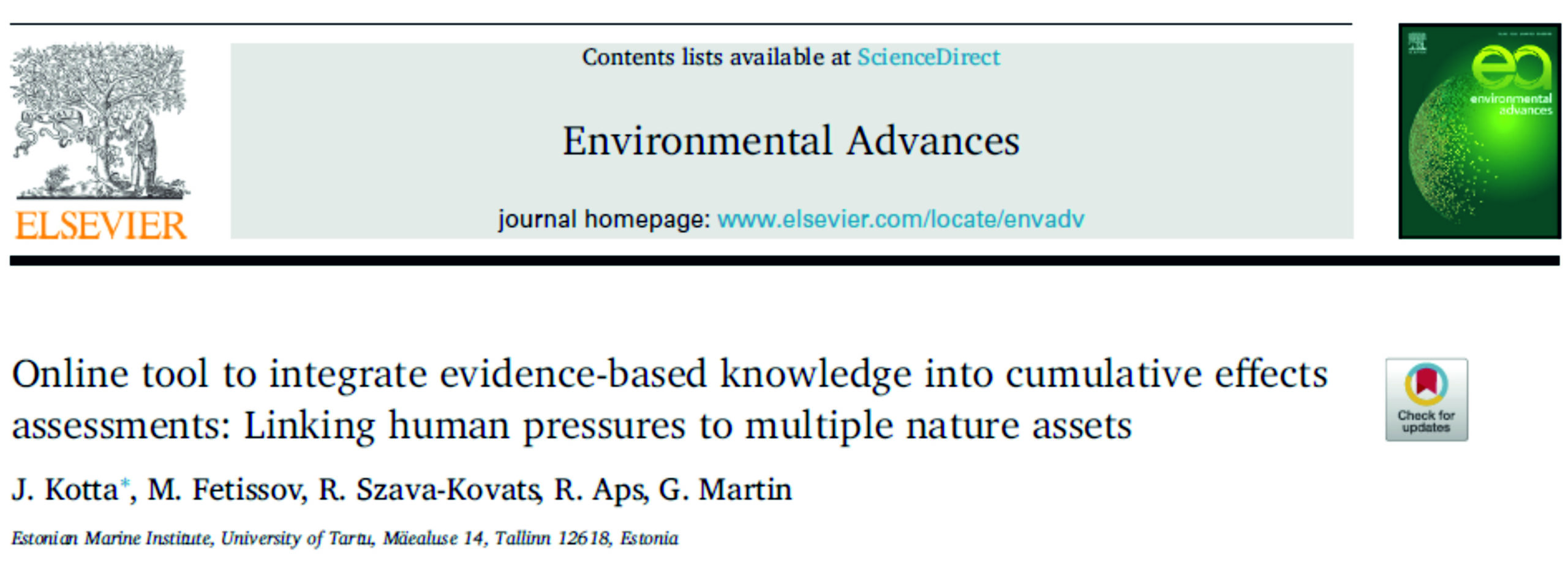
Online tool to integrate evidence-based knowledge into cumulative effects assessments: Linking human pressures to multiple nature assets
Jonne Kotta, Mihhail Fetissov, Robert Christian Szava-Kovats, Robert Aps, Georg Martin
Intensification and diversification of human-induced pressures in marine ecosystems have raised concerns over several sustainability-diminishing consequences, such as hypoxia and overexploitation of resources. We present the PlanWise4Blue tool (PW4B), which assesses the cumulative effects of multiple pressures on nature assets. In order to express the sensitivity of different nature assets to a plethora of pressure combinations, a meta-analysis based on published literature and available datasets was performed to calculate a set of standardized effect sizes. These calculations relied mostly on experimental or observational evidence; expert knowledge was used to estimate the impact coefficients only in the absence of impact data. Spatial modelling techniques (machine learning) were used to model the probability of occurrence and abundances of different nature assets in lattice grids with a cell size of 1 km2. Users can use the portal to estimate impacted areas and changes to natural assets caused by any combination of anthropogenic pressure. The PW4B tool can be used to predict individual and synergistic effects — both current and future — of a wide range of human activities and can be used regardless of scientific background. The tool was tested in the Baltic Sea region in coordination with the process of the Estonian Maritime Spatial Planning. This test evaluated the combined effects of human activity such as fisheries, aquaculture, wind energy, mining and maritime transport sectors on nature assets such as selected seaweed, invertebrate, fish habitats as well as bird and mammal species. The analyses showed that current Estonian maritime spatial planning will result in a moderate loss of some nature assets and a significant gain of benthic suspension feeders, although predicted losses in wind park areas can be mitigated if novel aquaculture activities such as mussel or macroalgal farming are established This test demonstrates how the PW4B tool can be used by planners to minimize adverse environmental effects, to suggest effective mitigation strategy, and to attain sustainable planning solutions.
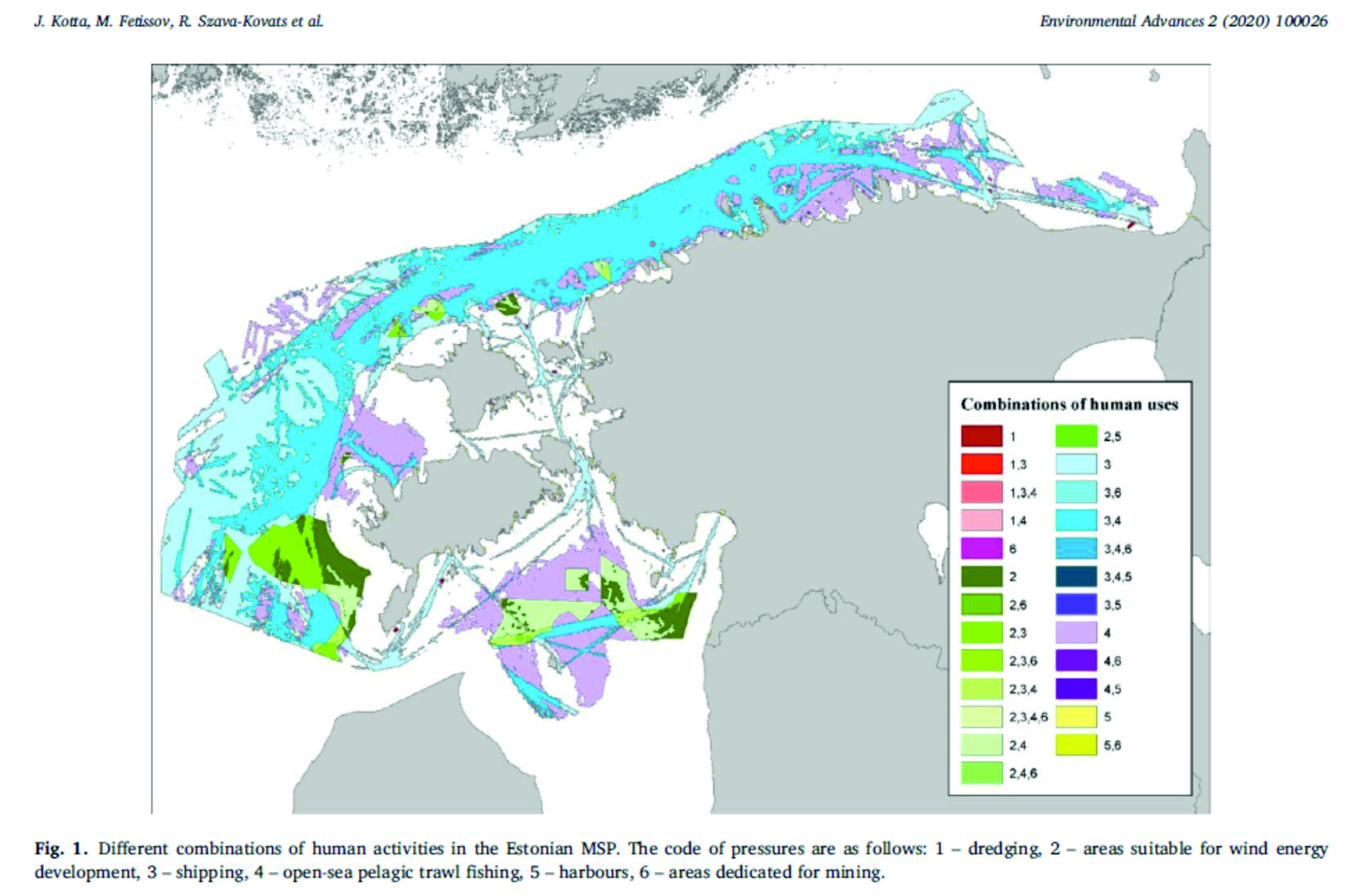
Supplementary material associated with this article can be found, in the online version at doi: 10.1016/j.envadv.2020.100026
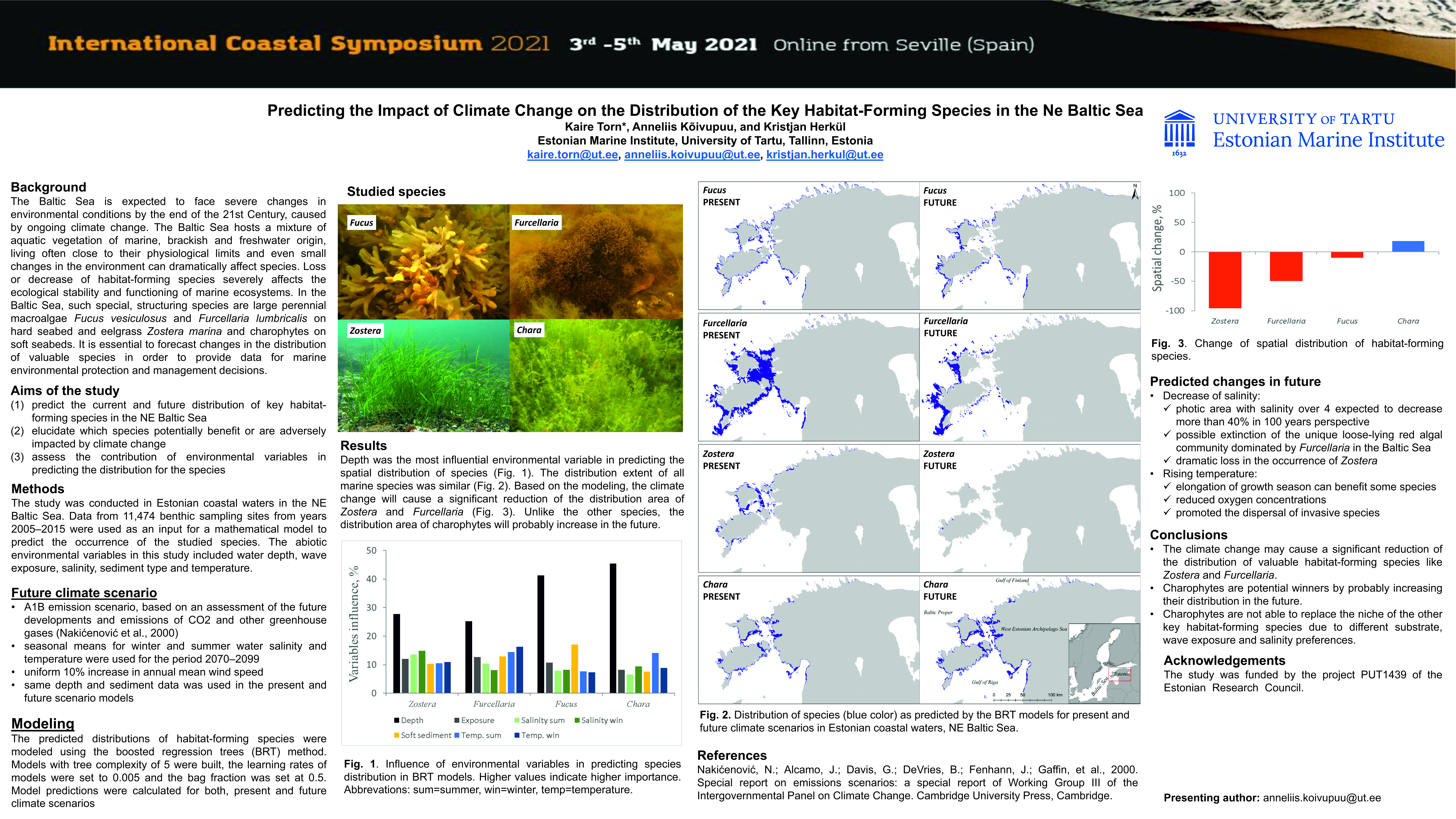
Predicting the Impact of Climate Change on the Distribution of the Key Habitat-Forming Species in the Ne Baltic Sea
Kaire Torn, Anneliis Kõivupuu, Kristjan Herkül
The predicted distributions of habitat-forming species were modeled using the boosted regression trees (BRT) method. Models with tree complexity of 5 were built, the learning rates of models were set to 0.005 and the bag fraction was set at 0.5. Model predictions were calculated for both, present and future climate scenarios.
The climate change may cause a significant reduction of the distribution of valuable habitat-forming species like Zostera and Furcellaria. Charophytes are potential winners by probably increasing their distribution in the future. Charophytes are not able to replace the niche of the other key habitat-forming species due to different substrate, wave exposure and salinity preferences.
Poster
Online version at doi: 10.2112/SI95-035.1
Meta-analysis on the ecological impacts of widely spread non-indigenous species in the Baltic Sea
Henn Ojaveer, Jonne Kotta, Okko Outinen, Heli Einberg, Anastasija Zaiko, Maiju Lehtiniemi
The introduction of non-indigenous species (NIS) is a major driver for global change in species biogeography, often associated with significant consequences for recipient ecosystems and services they provide for humans. Despite mandated by several high-level international legislative instruments, comprehensive quantitative evaluation on ecosystem impacts of marine NIS is scarce and lack a robust and data-driven assessment framework. The current study is aiming at fulfilling this gap, through quantitative assessment on the effects of the widespread NIS of the Baltic Sea on multiple ecosystem features and components including direct food-web effects. The outcomes of this study allowed identifying the most impacting widespread NIS, together with defining the processes underlying the most significant changes and outlined major sources of uncertainty. Lack and/or bias in the availability of evidence of impacts was recorded for several (both recent and early) introductions. Realizing a sophisticated, data and information-hungry framework for the evaluation of ecosystem impacts of NIS is not pragmatic for management purposes in the foreseeable future. Instead, simple approaches, such as application of common statistical parameters like absolute effect size, are more likely to result in tangible outcomes. As bearing no unit, effect sizes can be later easily aggregated across taxa, affected ecosystem features or spatial scales. The proposed approach enables performing systematic comparisons on the severity of impacts of different NIS along different study disciplines and ecosystems.
Online version at doi: https://doi.org/10.1016/j.scitotenv.2021.147375
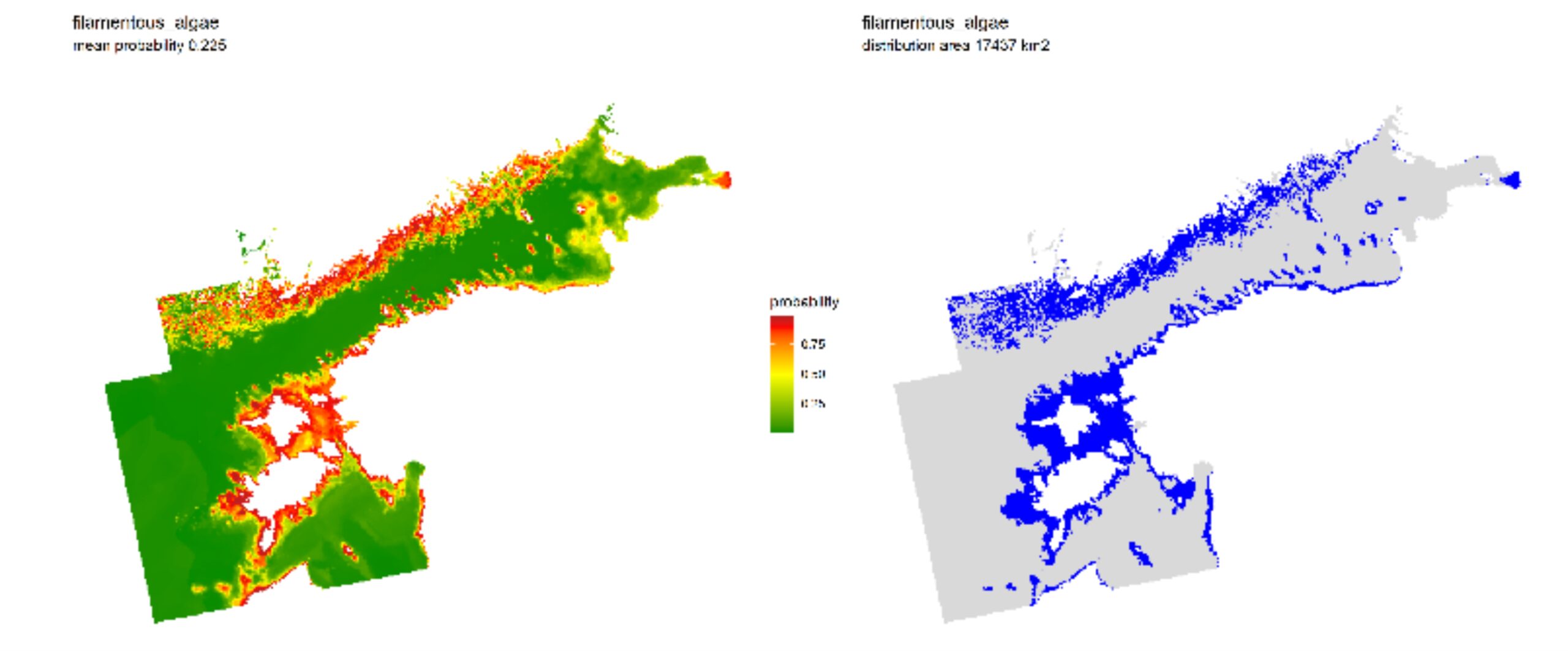
Mapping the biota and quantifying separate and synergistic impacts of human uses on joint nature assets. Activity Output T2.1.1
Jonne Kotta, Mihhail Fetissov , Kristjan Herkül, Helen Orav-Kotta , Anneliis Kõivupuu, Tiia Rosenberg, Marge Simo, Robert Christian Szava-Kovats, Annaleena Vaher
A fundamental component for the design of efficient policy and management actions is transboundary knowledge on the spatial patterns of different species, groups of species and biodiversity elements. This knowledge is a bases for developing well-informed ecosystem-based marine management systems. However, to date such information is not available for the entire Gulf of Finland area. The Activity Output T2.1.1 of the Adrienne project produced harmonized transboundary maps of important biological elements that are crucial for understanding the general spatial patterns of the marine nature assets.
In order to assess the impacts of different human pressures on different nature values accurate maps of nature assets are needed.
In the current modelling activity, we selected altogether 57 benthic species or groups of species to represent benthic nature values in the Gulf of Finland. These species/groups were selected based on occurrence rate (generally occurrence > 2.5 %) and ecological relevance (habitat formation, important ecological processes). Mapping the biota and quantifying separate and synergistic impacts of human uses on joint nature assets
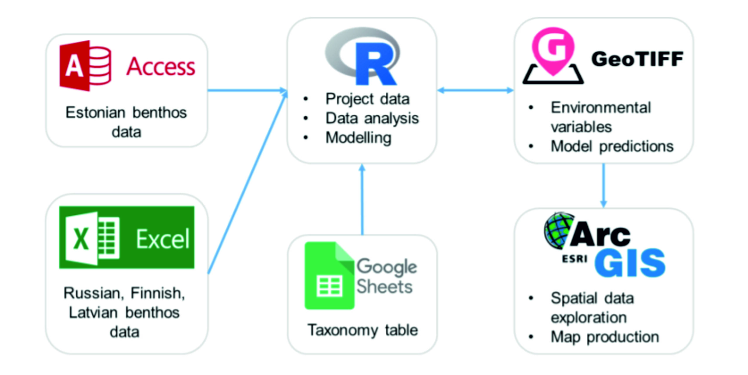
Report on Guidelines how to valuate biodiversity elements. Activity Output T1.1.2
The fate and fortune of the Baltic Sea are shared by all nations along its shores. As these nations continue to exploit the sea, so continues the responsibility of these nations to protect it. The efforts made by the participants of the Adrienne project as presented in this report show the systematic framework for this protection. Data from diverse sources is compiled and consolidated into a single consistent database. Mathematical modelling and remote sensing is used to extrapolate to areas where marine monitoring and sampling are too difficult or too costly to cover. Established knowledge and experimental data provide the means for ascertaining ecosystem response to environmental conditions and changes. Through state-of-the-art modelling these responses are mapped over the Gulf of Finland. Finally, potential future actions can be assessed against a quantifiable and standardized system of ecosystem services to assure the continued sustainable use of the Gulf of Finland. This framework is well-aimed at addressing the ongoing environmental challenges, but just as the Baltic Sea recognizes no border, so must Baltic scientists aim for trans-border cooperation and partnership.
Guidelines how to valuate biodiversity elements
Habitats in the Gulf of Finland.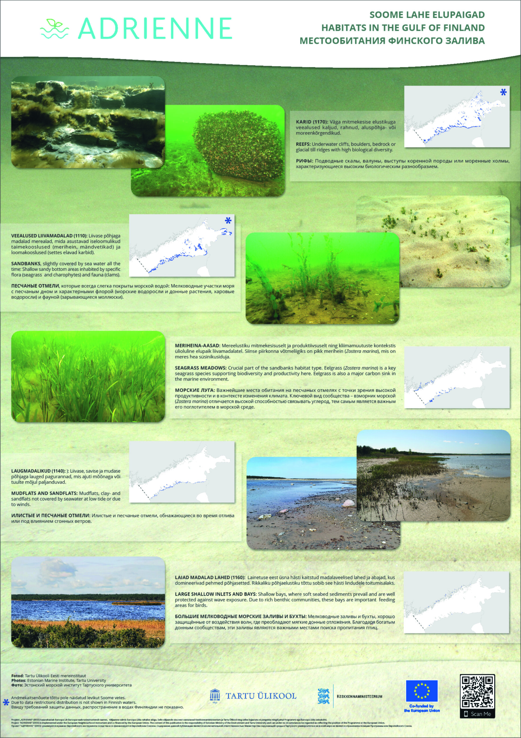
Soome lahe elupaigad. Habitats in the Gulf of Finland.pdf
“These publications have been produced with the financial assistance of the Estonia – Russia Cross Border Cooperation Programme 2014-2020. The content of this publication is the sole responsibility of University of Tartu and can under no circumstances be regarded as reflecting the position of the Programme, Programme participating countries alongside with the European Union”
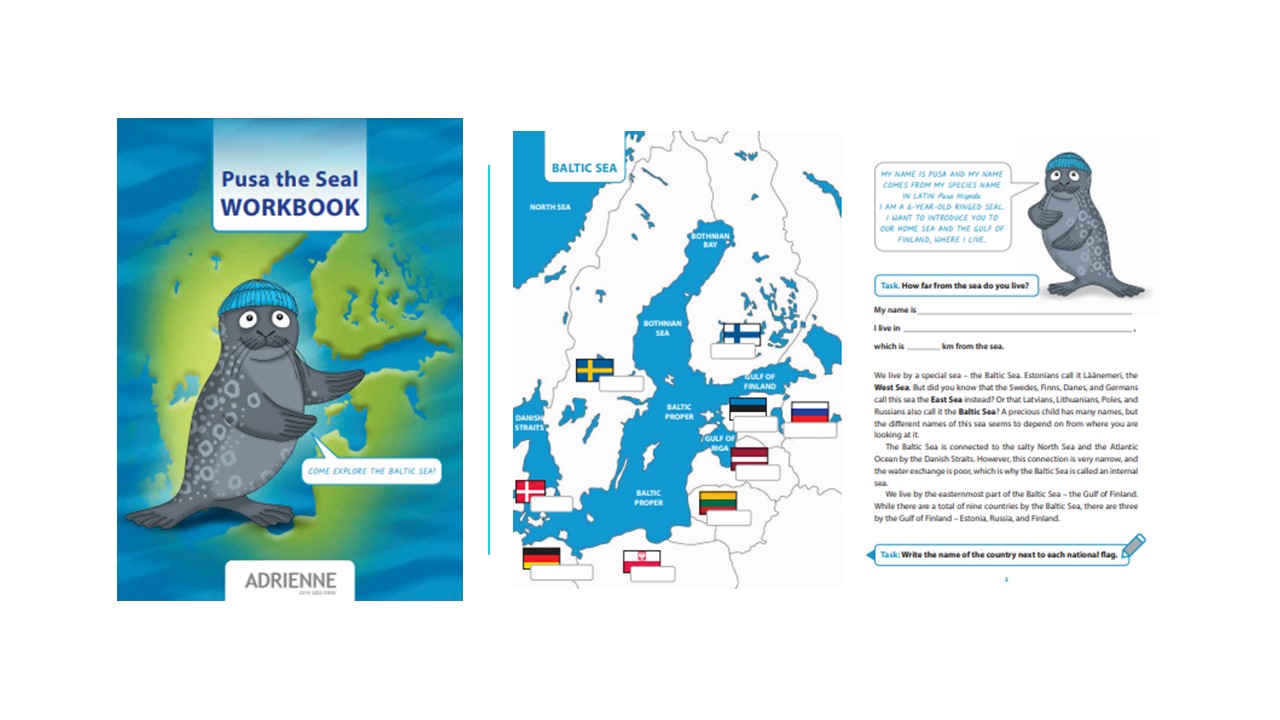
Pusa the Seal Workbook. Explore Baltic Sea with Pusa the Seal.
Stickers. Наклейки.
Балтийскоe морe рабочая тетрадь нерпенка Пуса. in Russian


